 Skipper
Navigate
•All boatersHow to Take a Bearing at Sea
Learn how to take a compass bearing, identify landmarks, plot position lines, and use multiple bearings to estimate your position at sea.
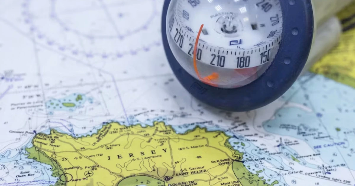
How to Take a Bearing at Sea
Knowing where you are is one of the foundations of safe navigation. GPS and chartplotters make it easier to monitor your position, but understanding how to take a bearing remains a valuable seamanship skill.
A compass bearing can help you identify the direction of a landmark, check your position on a chart, or independently verify information from electronic navigation equipment.
A bearing tells you the direction of an object from your boat. With suitable charted landmarks and more than one observation, you can use bearings to estimate your position.
This guide explains the basic concepts, how to take a bearing with a hand-bearing compass, and how to use bearings for coastal position fixing.
1. What Is a Bearing?
A bearing is the horizontal direction from one position to another, expressed as an angle.
In marine navigation, bearings are commonly expressed in degrees from 000° to 359°, measured clockwise from a specified reference direction.
For example:
- 000° is north.
- 090° is east.
- 180° is south.
- 270° is west.
A bearing of 045° points northeast when measured from north.
The reference direction matters. A bearing can be expressed relative to true north, magnetic north, or the boat’s heading, depending on the instrument and method used.
Bearing vs. heading vs. course
These terms are related, but they are not interchangeable.
| Term | Meaning |
|---|---|
| Bearing | Direction from your position to an object, or between two positions |
| Heading | Direction the boat’s bow is pointing |
| Course | The direction intended or followed over a particular segment of navigation |
| Track | The actual path travelled over the ground |
| Relative bearing | Direction to an object measured relative to the boat’s bow |
For example, your boat might be steering a heading of 090° while a lighthouse bears 135° from your position. The lighthouse is southeast of the boat, even though the bow points east.
The distinction is important when comparing visual observations with a chart or an electronic navigation display.
2. True, Magnetic, and Relative Bearings
Before taking a bearing, establish what reference your instrument uses.
True bearing
A true bearing is measured clockwise from true north, the direction towards the geographic North Pole.
Nautical charts normally use true bearings for plotted directions unless otherwise specified.
Magnetic bearing
A magnetic bearing is measured relative to magnetic north, the direction indicated by an ideal magnetic compass.
The difference between true north and magnetic north at a location is called magnetic variation, also known as magnetic declination.
Variation changes with geographic location and over time. Consult the relevant chart or current navigational information when converting between magnetic and true bearings.
A steering compass may also be affected by deviation: errors caused by magnetic influences aboard the boat. Deviation varies with the boat’s heading and should be considered when using that compass for accurate navigation.
Do not apply deviation automatically to every bearing. The corrections depend on the instrument and the reference being used.
Relative bearing
A relative bearing is measured from the boat’s heading rather than from north.
For example, an object directly off the starboard side has a relative bearing of approximately 090°.
Relative bearings are useful for describing where another vessel or landmark lies in relation to your boat. They are not directly interchangeable with true bearings without knowing the boat’s heading and the relevant reference corrections.
3. How to Take a Bearing with a Hand-Bearing Compass
A hand-bearing compass is a portable instrument designed to measure the direction of a visible object relative to magnetic north.
It is particularly useful for coastal navigation, where you can identify fixed features such as lighthouses, headlands, or prominent buildings.
Step 1: Choose a clear landmark
Identify an object that you can recognise confidently and, if you intend to plot your position, locate on your nautical chart.
Suitable examples include:
- A lighthouse.
- A prominent headland.
- A fixed navigation beacon.
- A conspicuous tower or building.
- A clearly identifiable point on the coastline.
Prefer fixed, charted features over floating objects that may move from their charted position. A buoy can still be useful when its position and reliability are understood, but it should not automatically be treated as an immovable reference.
Step 2: Hold the compass correctly
Follow the manufacturer’s instructions for your compass. Keep it level, allow the reading to stabilise, and avoid nearby magnetic objects that could influence the instrument.
If the compass has a sight or optical system, use it to align the instrument with the selected landmark.
Do not take the reading close to speakers, magnetic phone accessories, electrical equipment, or other sources of interference.
Step 3: Read the bearing
Read the angle indicated by the compass and establish whether it is a magnetic or true bearing.
Record the value clearly, including the reference if known. For example:
- 042° M means a magnetic bearing of 042°.
- 038° T means a true bearing of 038°.
The exact notation can vary, but the reference must be clear when you later use the observation on a chart.
Step 4: Record the time and conditions
If the bearing is being used to establish your position while underway, record the time of the observation.
Also note the boat’s heading or course and speed when relevant. These details help you understand the observation later, particularly if the boat is moving and several bearings are taken in sequence.
Step 5: Repeat with additional landmarks
For a position fix, identify other suitable charted objects and take additional bearings as close together in time as practical.
The quality of the result depends on the landmarks, the instrument, the corrections applied, and the angles at which the position lines intersect.
4. How to Use a Bearing to Estimate Your Position
A single bearing normally tells you that the boat lies somewhere along a line extending from the observed landmark. It does not usually establish a unique position on its own.
To estimate your position, you can plot the bearing on a chart and combine it with another independent position line.
Step 1: Identify the landmark on the chart
Find the same object on your nautical chart and confirm that you have identified it correctly.
A mistake in identifying the landmark can produce a plausible-looking but incorrect position.
Step 2: Convert the bearing if necessary
If the observation is magnetic and the chart requires a true bearing, apply the appropriate magnetic variation correction.
If you used a steering compass affected by deviation, that correction may also be required.
Use the current chart information and the appropriate correction convention. Do not assume that a compass bearing can be plotted directly as a true bearing.
Step 3: Plot the position line
A bearing from your boat towards a landmark describes the direction from your position to that object.
To plot the corresponding position line from the landmark on a chart, use the reciprocal direction, which differs by 180°.
For example, if the true bearing from your boat to a lighthouse is 060° T, the direction from the lighthouse back towards your boat is 240° T.
Plot the line through the charted landmark in that reciprocal direction. Your boat lies somewhere along that line, subject to observation and plotting errors.
Step 4: Add another independent position line
Take a bearing to a second known object and plot its corresponding position line.
The intersection of the two lines gives an estimated position fix.
However, two lines may intersect even when one or both observations contain errors. A third bearing provides a useful consistency check.
5. Taking a Three-Point Fix
A three-point fix uses bearings to three known landmarks to estimate a boat’s position.
It is a classic coastal navigation technique and can provide a useful independent check of electronic position information.
Choose good landmarks
For a reliable fix:
- Choose objects that can be identified confidently on the chart.
- Prefer fixed, clearly visible landmarks.
- Select landmarks at useful angular separations rather than clustering them in the same direction.
- Avoid relying exclusively on very distant objects when closer suitable ones are available.
- Take the observations as close together in time as practical, particularly when the boat is moving.
The geometry matters. If the position lines intersect at very shallow angles, even small bearing errors can produce a large uncertainty in the estimated position.
Plot the three bearings
After applying any necessary corrections, plot the three position lines on the chart.
In an idealised exercise, all three lines intersect at one point. In practice, they commonly form a small triangle rather than meeting perfectly.
This triangle is called a cocked hat.
The triangle reflects differences between the observations and the plotting process. It is not a guarantee that the true position lies within it, because errors can be larger or systematic.
If the triangle is unexpectedly large, review the landmark identification, compass readings, corrections, timing, and plotting. If you are near a hazard, take a conservative view of the uncertainty and do not assume the centre of the triangle is safe.
6. Common Mistakes When Taking Bearings
Confusing a bearing with a heading
The boat’s heading tells you where the bow points. A bearing tells you the direction of an object from your position.
Better approach: Record the two separately and specify whether a bearing is true, magnetic, or relative.
Forgetting magnetic variation
Plotting a magnetic bearing directly as a true bearing can introduce a significant position error.
Better approach: Check the chart’s magnetic variation information and apply the correct conversion.
Ignoring compass deviation
A steering compass can be affected by magnetic influences on the boat.
Better approach: Understand the limitations of the instrument and use the relevant deviation information when required.
Selecting the wrong landmark
Two similar-looking towers or an incorrectly identified headland can lead to an incorrect fix.
Better approach: Confirm the feature visually and on the chart before plotting.
Taking bearings from poorly positioned landmarks
Position lines that intersect at shallow angles can amplify small measurement errors.
Better approach: Choose landmarks with a useful spread around the horizon where practical.
Recording bearings at different times while moving
The boat changes position between observations, which can distort a fix if the movement is ignored.
Better approach: Take bearings promptly and record their times. Account for the boat’s movement when the method requires it.
Treating a plotted fix as exact
A charted intersection is only as reliable as the observations and corrections used to create it.
Better approach: Compare the result with other available information, including GPS, depth, visual transits, and the surrounding geography.
7. Bearings, GPS, and Modern Navigation
Electronic navigation systems make it easier to determine and monitor a boat’s position. A GPS receiver estimates position from satellite signals, while a chartplotter displays that position against electronic charts.
Visual bearings provide a different kind of information. They can help verify that the chart, the visible surroundings, and the electronic position are broadly consistent.
Useful practices include:
- Comparing your electronic position with identifiable charted landmarks.
- Checking that the coastline and navigation marks appear where expected.
- Using visual bearings as an additional position check when conditions allow.
- Maintaining knowledge of your position if an electronic display becomes unavailable.
- Keeping an appropriate paper chart and compass skills for the vessel and voyage.
A hand-bearing compass is not a replacement for every modern navigation tool, and a GPS position is not a substitute for looking out and understanding your surroundings. Using independent sources of information can help reveal errors.
8. When Are Bearings Most Useful?
Taking bearings is especially useful when navigating close to land, where clear landmarks are visible and accurately charted.
Examples include:
- Checking your position before entering a harbour.
- Confirming your position while approaching a headland.
- Monitoring progress along a coastal route.
- Cross-checking an electronic position near navigational hazards.
- Practising traditional navigation skills with the crew.
Visibility, sea conditions, landmark quality, and the boat’s movement affect how useful the observations will be. In poor visibility, or when landmarks cannot be identified reliably, other navigation methods may be necessary.
Record Your Navigation Experience with Skipper
Navigation decisions are worth reviewing after a trip, especially when you have practised traditional techniques or encountered challenging conditions.
You can record details such as:
- The route and GPS track of the trip.
- The landmarks used during coastal navigation.
- Notes about visibility, weather, and sea conditions.
- Any discrepancies you noticed between visual observations and electronic information.
- Lessons to apply on a future passage.
With Skipper, you can document your trips using GPS tracks, trip statistics, notes, and photos. These records can help you look back at where you went and the conditions you experienced.
Frequently Asked Questions
What is a bearing at sea?
A bearing is the direction from your boat to an object, expressed as an angle measured from a specified north reference or, for a relative bearing, from the boat’s heading.
What is the difference between a true bearing and a magnetic bearing?
A true bearing is measured relative to true north, while a magnetic bearing is measured relative to magnetic north. Magnetic variation must be accounted for when converting between them. A steering compass may also require a deviation correction.
How many bearings do I need to find my position?
Two independent position lines can provide a position fix. A third bearing is useful for checking consistency and revealing uncertainty. The accuracy depends on the quality of the observations and the angles at which the lines intersect.
Can I take a bearing using a phone or GPS?
A GPS receiver estimates your position from satellite signals; it does not automatically provide the same observation as taking a compass bearing to a visible landmark. A phone with suitable equipment or software may offer additional navigation tools, but you should understand what the tool measures and how reliable it is.
What is a three-point fix?
A three-point fix combines bearings to three known landmarks. The corresponding position lines are plotted on a chart to estimate the boat’s position. In practice, they often form a small triangle called a cocked hat rather than intersecting at a single point.
What is a reciprocal bearing?
A reciprocal bearing points in the opposite direction and differs by 180°. For example, the reciprocal of 060° is 240°. It is useful when plotting a position line from a landmark towards the boat.
Final Thoughts
Taking a bearing is a straightforward observation, but using it accurately requires attention to reference directions, compass corrections, landmark identification, and chart plotting.
Start by practising with a hand-bearing compass and clearly identifiable landmarks in familiar waters. Then learn to combine multiple bearings into a position fix and compare the result with your electronic navigation information.
The goal is not simply to obtain a number. It is to build a more reliable understanding of where your boat is and how confident you can be in that position.
Remember your days at sea
Skipper is a ship’s log app for sailboats and powerboats, available on iPhone and iPad. It records every trip with GPS and keeps your whole sailing history in one searchable logbook. Free for your first three trips.

Keep reading
Boat Navigation Lights Explained
Learn how to identify boat navigation lights, understand what they reveal about a vessel, and recognise the lights required at night and in restricted visibility.
All boaters
COLREGs: International Collision Regulations Explained
Understand the COLREGs, the international rules for preventing collisions at sea, including right of way, lookout, safe speed, navigation lights and sound signals.
All boaters
How to Anchor a Boat
Learn how to choose an anchorage, deploy an anchor, calculate anchor scope, check holding, and monitor your boat safely.
All boaters