 Skipper
Prepare
•All boatersBeaufort Wind Force Scale
Understand the Beaufort scale from force 0 to 12, with wind speeds in knots and km/h, sea conditions, practical sailing advice, and guidance for interpreting marine forecasts.
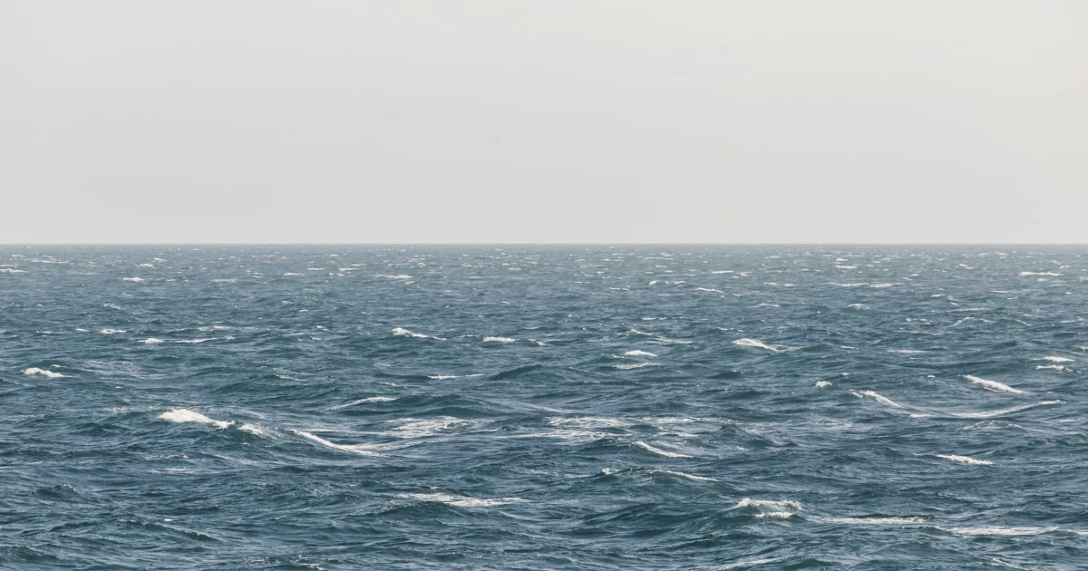
Beaufort Wind Force Scale: A Complete Guide for Sailors
The Beaufort wind force scale is one of the most widely used ways to describe wind strength in marine weather forecasts. It classifies conditions from force 0, calm, to force 12, hurricane force, using wind-speed ranges and descriptive terms.
For sailors and boaters, it provides a common language for interpreting forecasts, communicating conditions, and comparing observations made during a trip.
But the Beaufort number is only one part of the picture. It does not tell you everything about gusts, wave period, swell, visibility, or whether conditions are suitable for your particular boat and crew.
This guide explains all 13 Beaufort forces, compares their approximate wind speeds, and shows how to use the scale when planning a trip.
Beaufort wind scale chart
The following table uses commonly published marine Beaufort wind-speed ranges. Speeds in km/h and mph are approximate conversions from knots and are rounded for readability.
| Force | Wind description | Wind speed (knots) | Approx. speed (km/h) | Approx. speed (mph) |
|---|---|---|---|---|
| 0 | Calm | Less than 1 | Less than 2 | Less than 1 |
| 1 | Light air | 1–3 | 2–6 | 1–3 |
| 2 | Light breeze | 4–6 | 7–11 | 5–7 |
| 3 | Gentle breeze | 7–10 | 13–19 | 8–12 |
| 4 | Moderate breeze | 11–16 | 20–30 | 13–18 |
| 5 | Fresh breeze | 17–21 | 31–39 | 20–24 |
| 6 | Strong breeze | 22–27 | 41–50 | 25–31 |
| 7 | Near gale | 28–33 | 52–61 | 32–38 |
| 8 | Gale | 34–40 | 63–74 | 39–46 |
| 9 | Strong gale | 41–47 | 76–87 | 47–54 |
| 10 | Storm | 48–55 | 89–102 | 55–63 |
| 11 | Violent storm | 56–63 | 104–117 | 64–72 |
| 12 | Hurricane force | 64 and above | 119 and above | 74 and above |
These are rounded reference values. Published tables may differ slightly in their conversion and rounding. Beaufort force is associated with mean wind speed, not the highest speed reached during a brief gust.
Beaufort force 0: Calm
Wind speed: Less than 1 knot (less than 2 km/h or approximately 1 mph).
At force 0, the air is calm or nearly calm. The sea surface may appear smooth and mirror-like, although local conditions can still create small movements.
For sailors, this usually means little or no useful wind for sailing. A sailboat may make very little progress under sail unless a breeze develops.
Before leaving harbour, consider whether the forecast suggests the wind will remain light or increase later. If you plan to use the engine, account for fuel, operating limits, and the rest of your passage plan.
Beaufort force 1: Light air
Wind speed: 1–3 knots (approximately 2–6 km/h or 1–3 mph).
At force 1, the wind is very light. Small ripples may appear on the water, and its direction can sometimes be inferred from smoke or other light indicators.
A sailboat may move slowly, especially when sailing against a slight headwind or when the sails are not well filled.
Light air can be pleasant in sheltered water, but it can also make a passage take considerably longer than expected. Allow for slower progress when estimating arrival times.
Beaufort force 2: Light breeze
Wind speed: 4–6 knots (approximately 7–11 km/h or 5–7 mph).
At force 2, the wind becomes more noticeable. Small wavelets form, and a suitably equipped sailboat can generally make progress under sail.
These conditions can be enjoyable for relaxed sailing, depending on the boat, wind direction, and sea state.
However, light wind is not always straightforward. Wind shadows near land, changes in direction, and local effects can make the breeze inconsistent. A boat may also lose speed when the wind shifts forward of the beam.
When planning a trip in light air, allow for slower progress and avoid relying on an optimistic average speed.
Beaufort force 3: Gentle breeze
Wind speed: 7–10 knots (approximately 13–19 km/h or 8–12 mph).
At force 3, the wind is established enough to produce larger wavelets, with some crests beginning to break.
For many cruising sailboats, this can provide comfortable sailing conditions when the route and sea state are suitable. The boat may move at a useful speed without the handling demands associated with stronger wind.
Even so, the experience depends on the direction of the wind relative to the course. A beam reach may feel very different from a long upwind leg.
Use the forecast to consider both the outward journey and the return. A comfortable sail in one direction does not guarantee equally comfortable conditions on the way back.
Beaufort force 4: Moderate breeze
Wind speed: 11–16 knots (approximately 20–30 km/h or 13–18 mph).
At force 4, the wind produces small waves that become longer and more developed, with whitecaps appearing more frequently.
For an appropriately equipped boat and competent crew, these conditions can offer rewarding sailing. Boat speed may increase, but so can the loads on sails, sheets, and rigging.
Consider the following when assessing the forecast:
- Whether the sail plan suits the expected conditions.
- Whether gusts are forecast to exceed the mean wind significantly.
- Whether the sea state is compatible with the boat and crew.
- Whether the route offers enough sea room and suitable shelter.
- Whether conditions are expected to strengthen.
A force 4 forecast should be interpreted in context rather than treated as a universal green light to sail.
Beaufort force 5: Fresh breeze
Wind speed: 17–21 knots (approximately 31–39 km/h or 20–24 mph).
At force 5, waves become more pronounced and whitecaps are common. Spray may occur depending on the sea and wind conditions.
Sailing becomes more physically demanding, and the crew may need to manage sail area, boat balance, and manoeuvres more carefully.
Before departure, check the forecast for gusts and changes in wind direction. Assess whether your boat, sails, rig, and crew are prepared for the expected conditions.
On a cruising yacht, reducing sail may be appropriate depending on the boat and conditions. The correct sail plan is vessel-specific, so follow your boat’s guidance and your own training rather than relying on a universal rule.
If the forecast is beyond your experience, consider delaying departure or choosing a more sheltered route.
Beaufort force 6: Strong breeze
Wind speed: 22–27 knots (approximately 41–50 km/h or 25–31 mph).
At force 6, the wind is strong and the sea can become rough. Larger waves develop, and breaking crests may produce extensive foam in sufficiently developed conditions.
Boat handling, manoeuvres, and crew movement may become significantly more demanding. The consequences of equipment failure or an unexpected change in conditions can also become more serious.
For recreational sailing, this calls for careful assessment of the vessel, crew experience, route, and available shelter.
Before considering a trip, assess:
- Whether the boat is designed and equipped for the expected conditions.
- Whether the crew can manage the required sail configuration and manoeuvres.
- Whether the sea state is likely to be manageable.
- Whether there is enough sea room and a suitable route to shelter.
- Whether the wind is expected to strengthen further.
Do not treat the Beaufort number as a standalone decision. A sheltered location and an exposed coastal passage can present very different risks at the same wind force.
Beaufort force 7: Near gale
Wind speed: 28–33 knots (approximately 52–61 km/h or 32–38 mph).
At force 7, the wind is near gale force. Strong gusts and rough seas can make conditions demanding, and foam may be blown from breaking wave crests.
For many recreational sailors, these are serious conditions that require substantial experience, suitable equipment, and careful consideration of the entire passage.
If you are already underway, assess your options early. Depending on your position and circumstances, it may be safer to shorten the route, seek appropriate shelter, or alter your plan before conditions deteriorate further.
Do not assume that a nearby harbour or anchorage is automatically safe. Its suitability depends on the wind direction, sea conditions, access, and local geography.
Beaufort force 8: Gale
Wind speed: 34–40 knots (approximately 63–74 km/h or 39–46 mph).
Force 8 is classified as a gale. At sea, waves may become high, and breaking crests can produce significant spray and airborne foam.
These conditions can place substantial demands on a boat and its crew. Navigation, communication, manoeuvring, and maintaining control can become difficult, especially in exposed waters.
For most recreational sailing plans, a forecast gale should trigger a serious reassessment of whether to depart or continue. Follow official marine warnings and guidance relevant to your location.
If a gale develops while underway, the safest course of action depends on the vessel, its position, the sea state, and the available shelter. Avoid making decisions based on a general article alone; use your training, vessel-specific procedures, and current official information.
Beaufort force 9: Strong gale
Wind speed: 41–47 knots (approximately 76–87 km/h or 47–54 mph).
Force 9 is classified as a strong gale. Waves may be high, breaking crests can topple, and spray may affect visibility.
These conditions are hazardous for recreational boating and can make even routine operations difficult.
A forecast of force 9 is not a situation to approach casually. Follow official warnings, do not undertake an ordinary recreational departure into these conditions, and seek qualified maritime guidance where needed.
If you are already at sea, the appropriate response depends on the vessel, location, and immediate hazards. There is no single manoeuvre or route that is correct for every situation.
Beaufort force 10: Storm
Wind speed: 48–55 knots (approximately 89–102 km/h or 55–63 mph).
At force 10, the wind reaches storm force. In well-developed open-sea conditions, waves can become very high, and the sea surface may be heavily covered with foam.
These are severe conditions. Recreational sailing should not be planned in storm-force winds.
If a storm is forecast, prioritise avoiding exposure to it. Follow official marine warnings and the guidance of the relevant maritime authorities. If a vessel is already at sea, actions must be based on the immediate situation, the boat’s capabilities, and appropriate emergency procedures.
Beaufort force 11: Violent storm
Wind speed: 56–63 knots (approximately 104–117 km/h or 64–72 mph).
Force 11 is classified as a violent storm. In developed open-sea conditions, waves may be exceptionally high, with widespread foam and significantly reduced visibility.
These are extremely dangerous conditions, far beyond those intended for ordinary recreational sailing.
Avoid departure and follow official warnings and safety instructions. If already at sea, rely on professional maritime guidance, emergency procedures, and the capabilities of the vessel and crew.
Beaufort force 12: Hurricane force
Wind speed: 64 knots and above (approximately 119 km/h or 74 mph and above).
Force 12 is the highest category on the traditional Beaufort scale. It describes hurricane-force wind, with extremely severe conditions possible at sea.
In developed open-ocean conditions, the sea may be covered with foam and spray, with visibility severely affected.
This category represents extreme danger. Recreational sailing should not be undertaken in these conditions. Follow official warnings and instructions from the relevant authorities.
The Beaufort category does not itself identify a tropical cyclone. It describes wind force; tropical cyclones have their own meteorological classifications and warning systems.
Beaufort scale and wave height: What should sailors know?
Many Beaufort reference tables include an indicative wave height for each force. These figures can be useful, but they must be interpreted carefully.
Published wave-height estimates generally refer to well-developed wind waves in the open sea. They are not guaranteed measurements for a specific location.
Actual wave conditions depend on several factors:
- Wind duration: How long the wind has been blowing.
- Fetch: The distance over which the wind blows across the water.
- Swell: Waves that have travelled from another area.
- Water depth: Shallow water can change wave shape and steepness.
- Current: Wind opposing current can create steeper, more confused seas.
- Local geography: Headlands, islands, bays, and other features can affect wave conditions.
This explains why two locations with the same Beaufort force may experience very different seas.
A sheltered bay may have relatively small waves while an exposed coastline experiences much larger ones. Conversely, significant swell may remain after the local wind has eased.
For more detail, see Sea State Explained.
Beaufort scale versus sea-state scale
The Beaufort scale and sea-state classifications describe related but different things.
| Scale | What it describes | Main use |
|---|---|---|
| Beaufort scale | Wind force | Classifying wind strength |
| Sea-state scale | The condition of the sea surface | Describing wave conditions |
Some marine forecasts provide both wind force and sea state. Read both when available.
Do not assume that a Beaufort force automatically corresponds to one specific wave height or sea state. The relationship is approximate and depends on how the waves have developed and the conditions in the area.
How to use the Beaufort scale when planning a sailing trip
The Beaufort scale is most useful when combined with a complete marine forecast and an understanding of your boat and crew.
1. Check the forecast wind force
Identify the expected mean wind speed and its corresponding Beaufort force. Make sure you understand whether the forecast uses knots, km/h, mph, or another unit.
2. Check gusts and wind direction
A mean wind speed does not capture every short-lived increase in wind strength. Review the gust forecast and consider how wind direction affects your planned route.
3. Assess the sea state
Review wave height, period, direction, and swell where information is available. Consider whether the wind and current could interact to create steeper seas.
4. Consider the boat and crew
Your decision should account for the vessel’s design and condition, the sail plan, the crew’s experience, and the route’s exposure. A force that is manageable in one situation may be unsuitable in another.
5. Check how conditions will change
Look at the forecast for the full period of the trip. A moderate breeze at departure may strengthen later, or the wind direction may make the return leg more difficult.
6. Identify alternatives
Before departure, identify suitable shelter and alternative destinations. Decide what changes in conditions would make you postpone, shorten, or abandon the trip.
For the complete process, read How to Read Wind Conditions for Sailing and How to Plan a Sailing Trip.
Record wind conditions in your sailing logbook
A forecast tells you what conditions are expected. A sailing logbook helps you record what you actually experienced.
For each trip, consider recording:
- The forecast wind force and speed.
- Observed wind direction and any significant changes.
- Strong gusts or sudden increases in wind.
- Sea state and swell.
- Departure and arrival times.
- The route and distance covered.
- Changes to the original plan and why they occurred.
- Any observations that may help with future planning.
These records can help you understand how your boat behaves in different conditions and compare the forecast with the conditions encountered during the trip.
Skipper, the iPhone digital sailing logbook, lets you record GPS tracks, routes, distances, durations, and speeds, with the option to add weather details, crew, locations, notes, and photos. You can revisit your trip history, maps, and statistics after returning to shore.
A logbook complements weather forecasts; it does not replace current marine weather information or navigational judgement.
Frequently Asked Questions
What is the Beaufort wind force scale?
The Beaufort scale classifies wind force from 0 to 12. Each force corresponds to a range of mean wind speeds and descriptive terms, with observations of the effects of wind at sea or on land.
How many knots is Beaufort force 4?
Beaufort force 4 corresponds to approximately 11–16 knots, or around 20–30 km/h (13–18 mph). It is known as a moderate breeze.
How many km/h is Beaufort force 6?
Force 6 corresponds to approximately 22–27 knots, or around 41–50 km/h (25–31 mph). It is known as a strong breeze.
What Beaufort force is too windy for sailing?
There is no universal cutoff that applies to every boat and crew. Suitability depends on the vessel, crew experience, sea state, route, shelter, and forecast trend.
Strong winds require increasingly careful assessment. Gale-force and storm-force conditions are hazardous, and ordinary recreational departures should not be planned into such conditions.
Does Beaufort force tell you how high the waves will be?
Not precisely. Beaufort reference tables often include indicative wave heights for well-developed open-sea waves, but actual wave height depends on wind duration, fetch, swell, depth, and local conditions.
Is Beaufort force the same as wind gust speed?
No. Beaufort force is associated with mean wind speed. Gusts are brief increases above the sustained or averaged wind and may be substantially stronger.
Who created the Beaufort scale?
The scale is named after Sir Francis Beaufort, a Royal Navy officer who developed a wind-force scale in the early nineteenth century. It was initially based on the observable effects of wind on sailing ships and later became associated with standardised wind-speed ranges.
Understand the Wind Before You Sail
The Beaufort scale gives sailors a common language for describing wind force, from calm conditions to hurricane-force winds. Knowing the approximate speeds and descriptions helps you interpret marine forecasts and communicate conditions clearly.
But the number is only the starting point. Always consider gusts, sea state, wind direction, local effects, your boat, and your crew before making a sailing decision.
Make every trip easier to review with Skipper. Record your sailing routes, trip details, weather notes, and photos in a digital logbook, so you can learn from past passages and build a record of your time on the water.
Remember your days at sea
Skipper is a ship’s log app for sailboats and powerboats, available on iPhone and iPad. It records every trip with GPS and keeps your whole sailing history in one searchable logbook. Free for your first three trips.

Keep reading
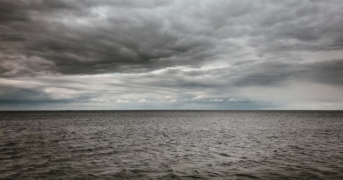
Clouds and Weather Signs for Sailors
Learn how to identify common cloud types, recognise signs of changing weather at sea, and combine sky observations with reliable marine forecasts.
All boaters
How to Plan a Sailing Route
Learn how to plan a sailing route using nautical charts, waypoints, distance calculations, weather forecasts, tides, and alternative destinations.
All boaters
How to Plan a Sailing Trip
Learn how to plan a sailing trip, from choosing your destination and checking the weather to preparing your boat, crew, route, and backup plans.
All boaters