 Skipper
Prepare
•All boatersClouds and Weather Signs for Sailors
Learn how to identify common cloud types, recognise signs of changing weather at sea, and combine sky observations with reliable marine forecasts.
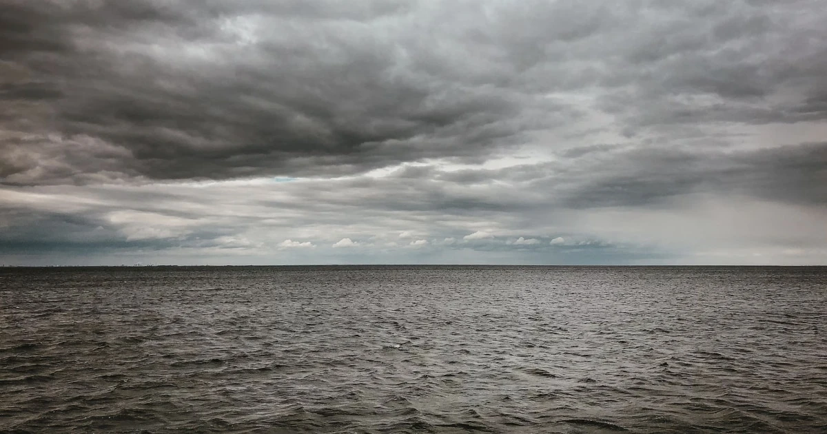
Clouds and Weather Signs for Sailors
The sky can tell sailors a great deal about changing weather. High, wispy clouds may appear ahead of an approaching weather system, growing cumulus clouds can signal increasing atmospheric instability, and towering cumulonimbus clouds can bring thunderstorms, squalls and sudden wind changes.
But cloud watching is not a substitute for a marine forecast. The same cloud type can occur in different weather situations, and important changes can develop beyond the visible horizon.
The most useful approach is to combine cloud observations, wind, visibility, sea conditions and official weather forecasts. Together, these clues help you recognise when conditions may be changing and when it is time to reassess your sailing plan.
Why do clouds form?
Clouds form when moist air cools enough for water vapour to condense into tiny water droplets or ice crystals.
This cooling can happen in several ways:
- Rising air: As air rises, it expands and cools. If it becomes sufficiently saturated, clouds can form.
- Weather fronts: When air masses with different temperatures meet, warmer air may be forced upwards, producing layers of cloud and precipitation.
- Surface heating: The Sun warms the surface, which can heat the air above it and cause it to rise, forming cumulus clouds.
- Air moving over terrain: Air forced upwards over hills or mountains can cool and form clouds.
- Cooling near the sea surface: Moist air passing over colder water can cool, potentially producing low cloud, mist or fog.
Understanding how clouds form helps explain why their shape, height and evolution can provide clues about the atmosphere.
The main cloud types sailors should recognise
Meteorologists classify clouds into ten main genera, commonly grouped by their typical altitude and appearance. For practical sailing, it is useful to start with a smaller number of recognisable types.
High clouds: cirrus, cirrostratus and cirrocumulus
Cirrus (Ci) clouds are thin, wispy clouds made mainly of ice crystals. They often look like feathers or delicate white streaks.
They may appear in fair weather, but a gradual increase in cirrus can sometimes indicate that a weather system is approaching.
Cirrostratus (Cs) clouds form a thin, high veil across much of the sky. They can produce a halo around the Sun or Moon when ice crystals refract the light.
A veil that spreads and thickens may be part of the cloud sequence ahead of an approaching front, although the pattern is not universal.
Cirrocumulus (Cc) clouds appear as small, white cloudlets or ripples high in the sky. They are often called a mackerel sky when arranged in a distinctive pattern.
Their presence alone is not a reliable forecast of rain or worsening conditions.
What sailors should look for: changes over time. A high, thin cloud layer that gradually becomes more extensive and thicker is more informative than a single observation of wispy clouds.
Middle clouds: altocumulus and altostratus
Altocumulus (Ac) clouds appear as patches or layers of rounded cloudlets, often white or grey. They can form rows, waves or larger cloud fields.
Some forms of altocumulus can occur in unstable air. If cloud elements grow vertically or the sky becomes increasingly active, pay attention to the wider weather situation.
Altostratus (As) clouds form a broad grey or blue-grey sheet. The Sun may appear dimly through the layer, like a disk behind frosted glass.
When altostratus thickens and lowers, it can be part of a system bringing more persistent precipitation.
What sailors should look for: whether cloud layers are spreading, thickening or lowering, and whether rain, a pressure change or a wind shift accompanies the change.
Low clouds: stratus, stratocumulus and nimbostratus
Stratus (St) clouds are low, uniform layers that can make the sky appear grey and featureless. They may bring drizzle and can occur with mist or fog.
At sea, low cloud and fog deserve particular attention because they can reduce visibility and make it harder to identify other vessels, coastlines and navigation marks.
Stratocumulus (Sc) clouds form low, lumpy layers or patches, often with darker areas and occasional gaps of blue sky. They commonly produce little or no precipitation, although showers are possible in some situations.
Nimbostratus (Ns) clouds form thick, widespread layers associated with persistent rain or snow. The Sun is generally obscured, and visibility can deteriorate in precipitation.
What sailors should look for: low cloud lowering towards the sea, deteriorating visibility, precipitation and changes in wind. These observations matter even when there is no dramatic cloud formation.
Clouds with strong vertical development: cumulus and cumulonimbus
Cumulus (Cu) clouds are the familiar white clouds with rounded tops and relatively flat bases. Small cumulus clouds often develop as the Sun heats the surface and rising air cools.
Small, well-spaced cumulus clouds can occur in relatively benign conditions. However, their appearance is not a guarantee of stable weather.
If cumulus clouds grow rapidly upwards and develop increasingly tall, cauliflower-like tops, they may indicate stronger convection.
Cumulonimbus (Cb) clouds are large thunderstorm clouds. They can extend through a substantial part of the atmosphere and may develop an anvil-shaped top.
Cumulonimbus clouds can produce:
- Thunderstorms and lightning.
- Heavy showers or hail.
- Strong, gusty and sometimes rapidly changing winds.
- Sudden changes in wind direction.
- Poor visibility in heavy precipitation.
- Locally hazardous sea conditions.
A thunderstorm can affect a vessel even when its centre is some distance away. Do not wait until a storm is directly overhead before taking its potential impact seriously.
What sailors should look for: rapid vertical growth, darkening cloud bases, anvil-shaped tops, showers, lightning, thunder and sudden wind changes. These are reasons to check official warnings immediately and act early.
What cloud patterns can tell you about changing weather
Recognising an individual cloud is useful. Observing how the sky changes over time is often more valuable.
1. High clouds gradually spreading and thickening
A sequence of high clouds followed by increasingly extensive middle and lower cloud can occur ahead of an approaching frontal system.
In some weather systems, cirrus appears first, followed by cirrostratus, altostratus and eventually thicker precipitation-bearing cloud.
This sequence is not guaranteed. Weather systems differ, and cloud observations alone cannot establish the timing or severity of a change.
Sailing takeaway: if the sky is progressively clouding over, compare your observations with the latest forecast and check whether wind, pressure or precipitation is also changing.
2. Cumulus clouds growing rapidly upwards
Cumulus clouds form when air rises and cools. If the atmosphere supports strong upward motion, these clouds can grow vertically and develop into showers or thunderstorms.
Rapidly growing towers are more concerning than small cumulus clouds that remain shallow.
Sailing takeaway: monitor the development of convective clouds, especially on warm days when showers or thunderstorms are forecast. Review your options before the weather deteriorates.
3. A dark, thick cloud layer with persistent rain
A widespread, thick layer of cloud accompanied by sustained precipitation may be associated with nimbostratus or a frontal weather system.
Rain can reduce visibility and make deck movement more difficult. Wind may also change as a weather system passes, depending on its structure and your position.
Sailing takeaway: check visibility, wind and the forecast rather than assuming that persistent rain will be accompanied by either stronger or weaker winds.
4. Low cloud, mist or fog developing over the sea
Low cloud and fog can develop when moist air cools, including when it passes over colder water. Coastal weather can also be affected by the movement of moist marine air onto land.
In the Mediterranean and elsewhere, marine air can produce extensive low cloud and reduced visibility in some conditions.
Sailing takeaway: prepare for restricted visibility if the horizon becomes indistinct, coastlines disappear or cloud lowers towards the sea. Follow the applicable collision-avoidance rules and use the vessel’s navigation equipment appropriately.
5. A sudden change in the sky accompanied by a wind shift
A changing cloud pattern becomes more significant when it occurs alongside a noticeable change in wind direction, stronger gusts, falling visibility or a marked change in pressure.
No single observation proves that a dangerous weather event is approaching. Several independent signs, considered alongside a forecast, provide a stronger basis for reassessment.
Sailing takeaway: when conditions begin to differ from the forecast, check for updated information and reconsider the plan rather than relying on the original departure assessment.
Other weather signs to watch at sea
Clouds are only one part of the picture. Sailors should observe the whole environment.
Wind direction and strength
Pay attention to changes in the true wind direction, the strength of gusts and whether the wind is becoming more variable.
A change in wind can occur for many reasons, including local effects, sea breezes, showers and passing weather systems. It should be interpreted in context.
Use the Beaufort Wind Force Scale to describe observed wind force, and consult How to Read Wind Conditions for Sailing for a broader guide to marine wind forecasts.
Atmospheric pressure
A barometer provides another useful observation. A sustained pressure trend can help indicate how the weather situation is evolving.
A falling pressure reading can be associated with an approaching low-pressure system, but the meaning depends on the wider pressure pattern and local conditions. A single reading is not enough to forecast a storm.
Compare pressure trends with official forecasts, cloud development and observed wind.
Visibility and the horizon
Monitor how clearly you can see the horizon, coastlines, navigation marks and other vessels.
Visibility can deteriorate in fog, mist, rain, haze or heavy showers. A clear sky does not guarantee good visibility, and cloud cover does not automatically mean visibility will be poor.
Sea state
Wind changes and weather systems can affect wave conditions, but the sea does not always respond immediately to the sky above it. Swell generated elsewhere can persist even when local weather appears calm.
For more detail, see Sea State Explained.
A practical example: observing a changing sky
Imagine you are sailing along the coast on a warm afternoon.
At first, the sky is mostly clear, with a few small cumulus clouds. Over the next hour, some clouds begin to grow much taller. Their tops become increasingly pronounced, and the forecast mentions a risk of thunderstorms later in the day.
A sensible response is to:
- Check the latest marine forecast and any thunderstorm warnings.
- Assess your position, route and distance from suitable shelter.
- Review whether the boat and crew are prepared for a possible deterioration.
- Consider changing the route or stopping earlier if the forecast and conditions warrant it.
- Continue monitoring the sky, wind, visibility and updated forecasts.
The key is not to predict the exact moment a storm will arrive from the clouds alone. It is to recognise a potentially important change early enough to make a considered decision.
What to do when you see signs of a thunderstorm
Thunderstorms can develop quickly, and conditions around them can be hazardous. Your response depends on your position, vessel, crew, available shelter and the specific forecast.
If you suspect a storm is approaching:
- Check official information. Review the latest marine forecast and warnings as soon as practical.
- Assess your options early. Consider your position relative to shelter, hazards and the storm’s expected movement.
- Prepare the crew and boat. Secure loose equipment, brief the crew and prepare for changing conditions in accordance with your vessel’s procedures.
- Review the sail plan. Make appropriate preparations before conditions become difficult, taking account of the boat, crew and forecast.
- Monitor wind and visibility. Be alert to sudden gusts, wind shifts, heavy precipitation and lightning.
- Avoid unnecessary exposure. If a safe alternative is available, consider whether continuing the passage remains appropriate.
Do not assume that a storm is harmless because it looks distant. Thunderstorms can affect areas beyond the visible rain shaft, and the direction and speed of movement may be difficult to judge from a boat.
For a trip that has not yet started, delaying departure may be the most prudent option when official forecasts indicate conditions beyond the capabilities of your boat or crew.
Why cloud watching cannot replace a marine forecast
Cloud observations are useful, but they have important limitations.
- Clouds may be obscured by darkness, haze or other cloud layers.
- A developing weather system may be beyond the visible horizon.
- The same cloud type can occur in different atmospheric situations.
- Local effects can cause conditions to differ from the wider forecast.
- Thunderstorms and squalls can develop or change faster than a sailor can reliably anticipate by eye.
Use official marine forecasts and warnings for your route and time window. In France, Météo-France’s marine weather service provides marine forecast information. Elsewhere, use the relevant national meteorological service and local warnings.
Cloud watching is best treated as an additional source of situational awareness: it helps you notice when the atmosphere is changing and prompts you to check whether your plan still makes sense.
Record weather observations in your sailing logbook
Recording what you observed during a passage helps you review how conditions evolved and compare your experience with the forecast.
Useful details include:
- Date, time and position.
- Cloud type or general cloud cover.
- Changes in cloud height, thickness or vertical development.
- Wind direction and estimated strength.
- Visibility and precipitation.
- Atmospheric pressure and its trend, if available.
- Sea state and any noticeable changes.
- Decisions made in response to changing conditions.
Keep observations factual. For example, “Towering cumulus developing to the west; gusts increasing” is more useful than recording a definite storm prediction that you could not verify.
With Skipper, you can keep a digital record of sailing trips using GPS tracks, route information and trip statistics, and add notes, photos, weather information and locations. Recording observations alongside a trip can help you revisit the conditions you encountered and reflect on the decisions you made.
Discover Skipper and build a useful record of your time on the water.
Cloud and weather observation checklist
Use this checklist when preparing for a passage and while monitoring conditions underway.
- Check the latest marine forecast and official warnings.
- Identify the main cloud types and note how they change.
- Watch for rapid vertical growth in cumulus clouds.
- Look for thickening cloud layers and approaching precipitation.
- Monitor wind direction, gusts and changes in strength.
- Observe visibility, especially if low cloud or fog develops.
- Check atmospheric pressure trends if you have a barometer.
- Compare observed sea conditions with the forecast.
- Reassess your route and shelter options if conditions deteriorate.
- Record significant observations and decisions in your sailing logbook.
Frequently asked questions
Which clouds should sailors watch most carefully?
Cumulonimbus clouds deserve particular attention because they can produce thunderstorms, lightning, heavy showers and strong gusts. Rapidly growing cumulus clouds may develop into cumulonimbus, so watch their evolution and check the forecast.
Do cirrus clouds mean bad weather is coming?
Not necessarily. Cirrus clouds can appear in fair weather, but a gradual increase and thickening of high clouds can sometimes indicate an approaching weather system. The wider pattern matters more than one cloud observation.
What do towering cumulus clouds mean?
Towering cumulus clouds indicate strong upward air movement. They can develop into showers or cumulonimbus clouds if the atmosphere remains unstable. Monitor their growth and compare it with official forecasts.
Can clouds predict wind strength?
Clouds provide clues about atmospheric processes and possible weather changes, but they cannot reliably tell you the wind speed or gust strength that you will experience. Use marine forecasts and direct observations of the wind.
What should I do if I see a cumulonimbus cloud?
Check current marine warnings, assess your position and available shelter, prepare the crew and boat, and reconsider whether continuing the passage is appropriate. Do not wait until the storm is overhead to assess your options.
Can the sky look calm while dangerous weather is approaching?
Yes. Important weather may be beyond the horizon, obscured by other clouds or developing in ways that are not obvious from a single observation. Continue to use official forecasts even when the sky looks reassuring.
Final thoughts
Clouds are valuable clues to what the atmosphere is doing. High clouds may be part of an approaching weather system, growing cumulus clouds can indicate increasing instability, and cumulonimbus clouds can bring hazardous thunderstorms and sudden wind changes.
The most useful skill is to observe how the sky changes and compare those observations with wind, visibility, sea conditions and reliable marine forecasts. When the evidence suggests conditions may deteriorate, reassess your plan early.
A sailing logbook can help you preserve those observations and learn from the weather you encounter on each trip.
Remember your days at sea
Skipper is a ship’s log app for sailboats and powerboats, available on iPhone and iPad. It records every trip with GPS and keeps your whole sailing history in one searchable logbook. Free for your first three trips.

Keep reading
Beaufort Wind Force Scale
Understand the Beaufort scale from force 0 to 12, with wind speeds in knots and km/h, sea conditions, practical sailing advice, and guidance for interpreting marine forecasts.
All boaters
How to Plan a Sailing Route
Learn how to plan a sailing route using nautical charts, waypoints, distance calculations, weather forecasts, tides, and alternative destinations.
All boaters
How to Plan a Sailing Trip
Learn how to plan a sailing trip, from choosing your destination and checking the weather to preparing your boat, crew, route, and backup plans.
All boaters